Hiking
About 80 % of the area is covered with forest, it´s ideal for hiking and walking.
Sonnenweg to the Wolfsburg

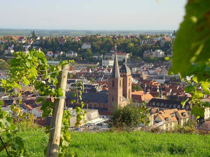
Starting point: Neustadt, Strohmarkt
Distance: about 3 kms (one way)
Level of Difficulty: 2
Trail Marker: red dot
The trail starts at the Strohmarkt and leads initially up the numerous steps of the old stone stairway, Haardter Treppenweg, towards the village of Haardt . At the entrance to the Dr. Welsch terrace, you turn left . Of course, you can also do a small tour of the Dr. Welsch terrace, admire its exotic plants and enjoy the view of Neustadt ( - and so you should ). Past the impressively-renovated Hüllsburg, the trail leads you past old terraced vineyards and gardens. From here, you have a wonderful view over the city of Neustadt an der Weinstrasse, looking over to the Hambacher Höhe, on the opposite side of the valley and also far away into the Rhine Valley. After about 4 kms you reach the ruins of the Wolfsburg.
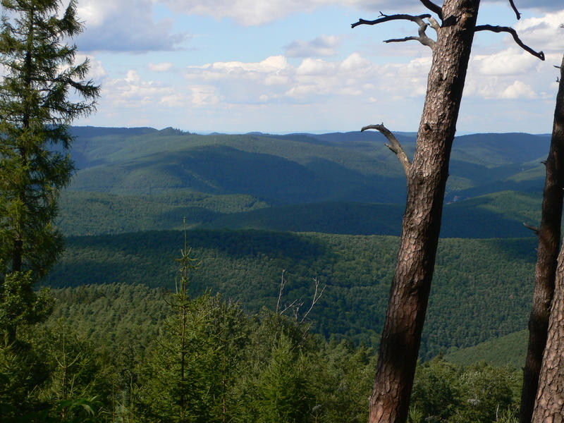
A hike up to the Kalmit
Starting point: The main railway station in Neustadt
Distance : 22 kms
Level of Difficulty: medium
The tour begins at the main railway station of Neustadt an der Weinstrasse. You turn left and cross back over the railway bridge leading to the “Alter Viehberg” , follow this street until you can turn right into the “Waldstrasse” which you follow up to the edge of the forest. On a winding path you leave the monastery on your right and follow the red circle trail marker leading past the “Nollensattel” after which you will shortly reach the forest. Past the “Speierheld” log cabin you are now on the “Hohe Loog” level track and continue until you reach the “Hohe Loog” forest house, from where you can already see the summit of the Kalmit, your next milestone . Continue to follow the red circle trail marker until you finally reach the parking lot “Hahnenschritt” after which you will, with little further effort, finally reach the summit of the Kalmit with the Kalmithaus . Here you can enjoy the view over the Rhine Valley and on a good day, of the Odenwald on the northern edge of the Black Forest. The way back leads on the same path back to the parking lot . At the next junction, you can opt out for the path with the blue-white bars trail marker. Going this way you go through the Kaltenbrunner valley to the Kaltenbrunner forest tavern. Here you have the possibility to continue your way back on the blue-white bars trail back. However, if you would like to add a short round trip, you can choose the path with the red-white strips marker until you reach the “Hellerhütte” forest cabin. Here you can eat and drink something before following the yellow and then the white dotted trail until you reach again the Kaltenbrunner forest tavern. You then take the path with the blue-white bars, passing the natural monument “Hermannsfels”, before taking a left fork and following the path back to the monastery. You then go back down the Waldstrasse and Alter Viehberg before you finally get back to your starting point, the main railway station .
From Neustadt over the Weinbiet to the Wolfsburg
Starting point: The main railway station of Neustadt
Distance: 12 kms
Level of Difficulty: medium
This round trip tour leads you from Neustadt an der Weinstraße up to one of the highest hills in the Palatinate Forest, the Weinbiet and to the ruined castle of the Wolfsburg.
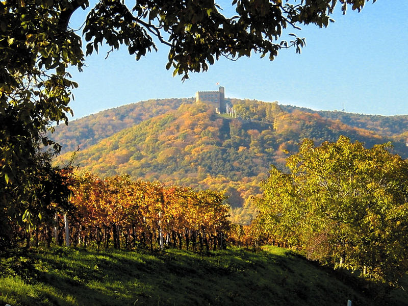
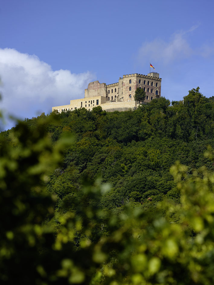
Hambach Castle
Starting point: Neustadt- Zwockelsbrücke
Distance: about 9 kms, round trip
Gradient: 200 m
Trail marker: red bar
" Up, up to the castle... ": In the same way as the participants of the Hambach Castle uprising of 1832, you can also walk up to the Hambach Castle, leaving, however, the pitchforks and flags of the original uprising at home The trail starts above the main train station . . . , just behind the railway crossing Zwockelsbrücke, on the opposite wall, you will see the trail markers of the Pfälzerwald-Verein forest club. From now on, you only need to follow the red bar trail marker and reach Hambach Castle after about four kilometres.
Recommended. A small extension of the tour ( about 2 kms) via the Andergasse to the Klausentalhütte above the village of Diedesfeld ( same trail marker until shortly before Klausentalhütte , then turn right into the forest to the hut following the blue dot. Hambach Castle can also be reached from the south-east, from Diedesfeld via the Klausentalhütte and the Zeter Berghaus.
Around the Town of Neustadt
Starting point: Neustadt, Zwockelsbrücke
Distance: about 29 kms, round trip
Level of Difficulty: 5
Gradient: 760 m
Trail markers: a yellow dot and white-red bar
After leaving the Zwockelsbrücke , at the beginning of Karolinenstraße, the yellow dot trail marker will lead you, after 7 kms, to the "Kleinen Ebene ". Here there is a shelter and seat benches. At the crossing, follow the yellow-dotted trail past the “Hellerhütte”. Now follow the red bar trail (first in a southern direction) to the Schützhütte (shelter) (4,5 kms) . Then take the white- green trail marker (about 3 kms) to the Leonhard -Klein- Quelle, a delightful spot with a beautiful view and tables and benches inviting you to rest . Continuing along the white- green trail, you will reach the wonderful vantage point looking over the ruined castle “Spangenberg” and the castle tavern (open weekends only) . Then, from the castle down to the " Höllischtal " . Here, you follow the white- red bar on your way back. After 4 kms you will pass the “Hellerhütte” again and after another 3 kms, alongside the forest ponds , you will reach the Kaltenbrunnerhütte. Now take the 4 km mark white-red bars trail marker for another 4 kms before, after a total of 29 km, the starting point is reached again.
Around the Weinbiet
Neustadt’s highest hill ... the Weinbiet can be explored in two varied walks.The Weinbiethaus is situated at an elevation of 555 m and in good weather, guests do not just sit on the terrace , but enjoy also the “playground” of Mother Nature.
A special tip - "Singing at the Weinbiet ": Tuesdays from 14.00 - 16.00 (in winter 13.00 - 15.00) , the " WEINBIETMUSIKANTEN ", a local choir with musicians play and sing for you . Songbooks are also distributed so that everyone can sing along with them. At the beginning of each performance a large brass bell will sound and to finish, a poem is recited in local dialect. An experience to be remembered ...
The Weinspange
Starting point: Parking, Hambach Castle
Distance: about 14 km
Level of difficulty: 3
Gradient: 300 m
Trail markers: a black "W" on a white background
In the "good old days", wine was still transported by horse or ox-drawn carts and wheelbarrows from the wine villages along the edge of the Palatinate Forest and into the Elmsteiner valley. The Weinspange is just such a historic wine-transport trail.
Route: From the parking lot at Hambach Castle - Hohe Loog – Totenkopf – Leonhard-Klein-Quelle – Burg Spangenberg – Erfenstein.
The way back is possible via the Hellerhütte (white-red markers), past the old ponds belonging to the bishops of those times, past the Kaltenbrunnerhütte, Konigsmühle and further down the white-red trail to the Zwockelsbrücke (and main railway station in Neustadt).
Tour
Königsbach-Pfalzblick
Starting point: Parking in the Klausental in Königsbach
Distance: about 18 km
Level of Difficulty: 2-3
Gradient: 320 m
Trail markers: red - white bars / red circle
The trail starts passing the Stations of the Cross to the Klausenkapelle. Here you keep to the left, following either the red-white bars of the trail markers of the number “4”. After a left turn, you can either go via the relatively steep trail marked by red and white bars or you stay on the gently sloping trail of the "4". After the paths meet again, stay on the "4" until the log cabin “ Königsbacher Sängerklause” appears on your right. Then it goes further following the red and white bars up a serpentine path up to the Stabenberg-Gipfel. The red - white trail marker overlaps with the red dot at a junction. You now follow the trail with the red dot. After about another 1 km, you turn right at a junction, and take a narrow path to your left marked with a "3 " towards the Pfalzblick, (a narrow path that looks more like a trench ). Stay on the " 3" which joins the red-white bars trail again and after about 20 minutes you are back at the parking lot in the Klausental.
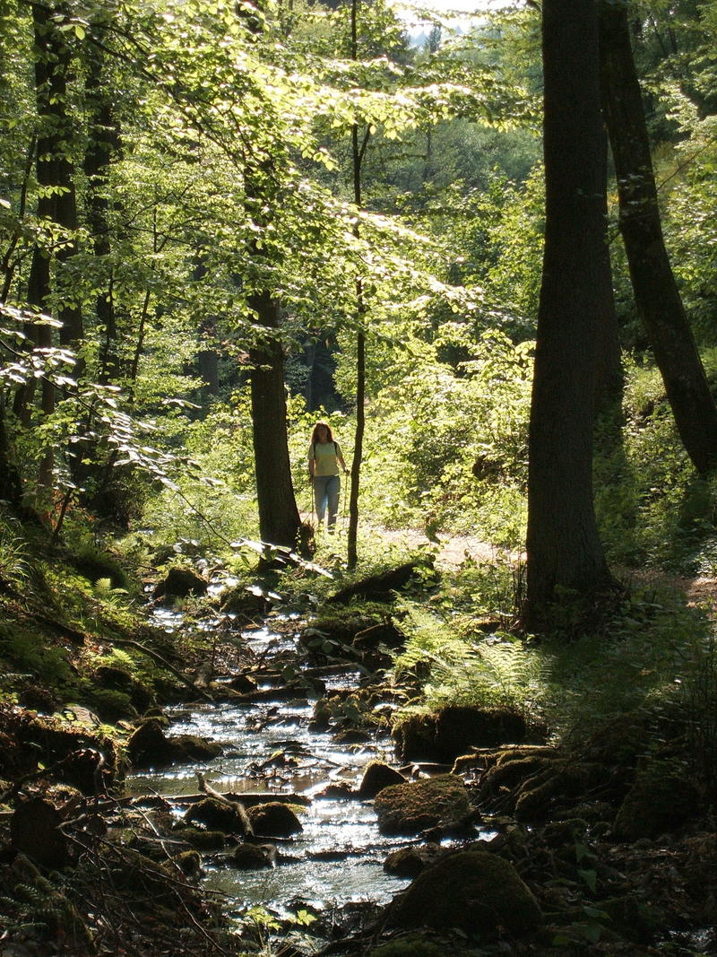
Quellenwanderweg
The trail of the river sources ...... refreshing, in the true sense of the word. Starting point: Conrad-Freytag-Blick
Distance: about 16 kms (one-way)
Gradient: 400 m
Trail markers: a blue "Q" on a yellow background
This particularly "refreshing" trail leads past the river sources: Kaltenbrunner and Finstertaler, Hirschtalbrunnen, Sternberg, Kühungerquelle, Michelsquelle and Triftbrunnen and offers many picturesque views into the Palatinate Forest.
Neustadt an der Weinstrasse is located directly on the Kneipp-Wanderweg Pfalz. The Quellenwanderweg and the Wald-und Naturlehrpfad Haardt, described below, are two worthwhile detours from this over 200 km long hiking tour.
Tour
Neustadt-Bad Dürkheim
Starting point: Neustadt, Strohmarkt
Distance: about 18 km ( one-way )
Level of Difficulty : 2
Gradient: 50 m
Markings: green grapes on a white background
The entire trail, Deutsche Weinstraße actually leads over a distance of about 100 kms from Bockenheim in the North to the Weintor in Schweigen to the South, on the border to Wissembourg in Alsace. Obviously, it is always possible to do this trail in stages, for example, from Neustadt an der Weinstrasse to Deidesheim, Wachenheim or Bad Dürkheim (or vice versa).
Between Neustadt an der Weinstrasse and Bad Durkheim there are regular train connections, every half-hour, with which you can easily return to your starting point. The trail leads along the edge of the Palatinate Forest and offers beautiful views over the vineyards and the Rhine valley. The picturesque wine villages along this trail are Gimmeldingen, Königsbach, Forst, Wachenheim and Bad Durkheim.
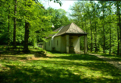
Drei-Burgen-Wanderweg

Starting point: Erfenstein
Distance: 7 kms
Starting point for this round trip is a sandstone block at the junction of Schankentalstrasse in Erfenstein.With a gradient of about 300 metres, the tour can be done in two to three hours. From the car park in Erfenstein, you cross the road between Frankeneck and Elmstein and follow the white- green or white-red trail marker through the valley of Schankental. The Erfenstein Castle lies on your left-hand side. 300 metres beyond the last house there is a path marked with white-green trail marker and signposted" Esthal 4.5 km ", which leads you directly to the castle ruins . After visiting the ruins, follow the white-green or white-red trail markers in the direction of a distinctive rock formation, after which you take the forest path marked with a "1”.The Spangenberg Castle remains on your left. The path leads for another 500 metres to a fork in the road, where a forest track leads up out of the valley. Continue along the forest path marked with a "1 " until you reach street level : Immediately at the junction, a horse path leads uphill for a further 300 metres. You then turn left down a narrow path which ends in Breitenstein, at the parking lot . Behind the parking lot (towards Elmstein ) is an impressive stone boulder carved with the words - " R. Breitenstein, 500 Schritt "). Follow the steep gravel path for a further 300 metres to a step-like entrance on the left which will lead you via an old castle path to Ruine Breitenstein ( via the gatehouse on the lower castle you can get to the upper castle ).To continue the walk, one can take the wide trail right down through the forest and back to the parking lot. From there, turn towards the Totenkopfstraße (marked with a " 1 ", green-white or green-blue). After passing over the railway of the “Kuckucksbahn” you take the forest path to your left, immediately opposite the trail to the Forsthaus Breitenstein and follow this path which runs parallel to the Totenkopfstraße. After 300 metres you take a left turn up a steep gravel path (Alte Weinweg) and take the first path on the left . After approx. 1000 metres you will see a bench seat where you turn right past the wooden carving of the Stutgarten and up to the castle well.Here you have a choice : you can either turn left onto a horizontal path that leads you in five minutes to Castle Spangenberg, or you can climb to the right follow a forest path to your left until you arrive at a sandstone quarry where the sandstone blocks which were broken out to round off the grazing sites 500 years ago still remain. Ignoring the signs to the castle well, you remain on this trail up to the castle. The descent to your starting point is done via the Alten Burgweg castle path in less than 10 minutes .
Tour
See also: